
Demjok (also spelled Demchok) is a sensitive zero-border village in the Leh district of Ladakh, India. Demchok previously called New Demchok, and called Parigas by the Chinese, is a village and military encampment in the Indian-administered Demchok sector, , that is disputed between India and China.
| Name | Usage | Notes |
|---|---|---|
| Demchok | Official Indian English spelling | Used by the Government of India, maps, and most travel references. |
| Demjok | Historical and phonetic spelling | Found in older British records and some academic publications. |
| Dechhog | Tibetan/Wylie transliteration | Derived from the Tibetan name བདེ་མཆོག (bDe-mchog). |
Demchok (also spelled Demjok or Dechhog) is a border village in the Nyoma subdivision of the Leh district in the Union Territory of Ladakh, India
Demjok Village Overview
Demjok is a sensitive border village with historical significance. It features vast plains and remote terrain, offering unique insights into frontier life. In 2019, the village had a population of 69 people only.

 6°C
6°C



| Village Name | Demjok |
| District | Leh Ladakh |
| Sub-Division | Nyoma |
| Block | Nyoma |
| Ethnic People | Changpa |
| Population (Approx) | 69-200 |
Demjok: A strategic border village near the Indo-China boundary. | Remote extreme destination.
Demchok Through History
Demchok was described by a British boundary commission in 1847 as a village lying on the border between the Kingdom of Ladakh and the Tibet. A historic Himalayan border settlement shared by Ladakh and Tibet for centuries.
English
Demchok
Tibetan
ཌེམ་ཆོག
Wylie
bde mchog
Romanization
Dem Chok / Dêmqog
Historical Timeline
Treaty of Tingmosgang
The Treaty of Tingmosgang established the local stream—today known as the Demchok River, Charding Nullah, or Lhari Stream—as the traditional boundary between Ladakh and Tibet.
British Boundary Survey
A British boundary commission described Demchok as a small settlement located directly on the border between the Kingdom of Ladakh and Tibet. The village consisted of only a handful of huts and tents, with a stream flowing through the middle that separated the two territories.
Settlement Records
Historical accounts recorded approximately 8–9 houses belonging to Tibetan landholders on the Tibetan side, while the Ladakhi side contained only two houses.
Modern Border
Today, the historic village area lies across the Line of Actual Control (LAC), separating India’s Union Territory of Ladakh from China’s Tibet Autonomous Region.
Historic Boundary
The Demchok River has long served as a natural geographical marker between Ladakh and Tibet.
Historic Importance
Despite its small size, Demchok became one of the most significant Himalayan border settlements due to its strategic location.
Location
Situated along the Indus River in southeastern Ladakh near the India–China border.
Although Demchok was once a tiny village divided by a mountain stream, its location has made it one of the best-known historic frontier settlements in the Himalayas. Today, the area remains strategically significant while preserving its place in the history of Ladakh and Tibet.
Etymology
The village of Demchok was apparently named after Demchok Karpo (also “Demchok Lhari Karpo”), the rocky white peak behind the present Ladakhi village of Demchok.
How Demchok got its name and how the settlement evolved over time.
Named After a Mountain
The name Demchok is believed to have originated from Demchok Karpo, a striking white rocky mountain peak overlooking the present-day village on the Ladakh side. The mountain has long served as a prominent natural landmark in the region.
Historic Settlement
Before 1947, the principal settlement of Demchok was located on the Tibetan side of the traditional border. The small settlement on the Ladakhi side was also known as Demchok, reflecting the area’s shared historical identity.
Modern Naming
Today, Chinese authorities use the name Demchok for the settlement on the Tibetan side, while referring to the settlement on the Ladakh side as Parigas (also spelled Barrigas).
Historical Note
Throughout history, the name Demchok has been closely associated with both the mountain and the surrounding settlements. Over time, administrative boundaries changed, but the historic name continues to be widely recognized for the region as a whole.
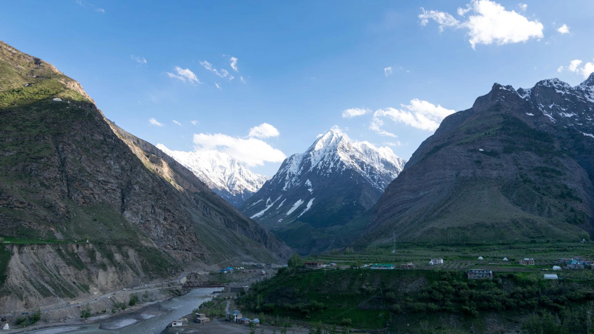
Landscape & Environment
Leh is the largest district in the country in terms of area. It is one of the coldest and most elevated inhabited region of the world having 112 inhabited and 1 uninhabited villages.
| Distance from Leh | ~300 km |
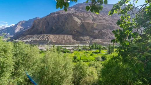
| Scenic Landscape & Environment | Vast plains and stark terrain |
| Culture & Lifestyle | Military presence and sparse settlements |
Things To Do
🏔️ Admire Demchok Karpo Peak, the white rocky mountain that overlooks the village and is believed to have inspired its name.
📸 Capture stunning photographs of the dramatic Himalayan landscapes, rugged mountains, and pristine valleys.
🌊 Visit the upper reaches of the Indus River, one of Asia’s longest and most historic rivers.
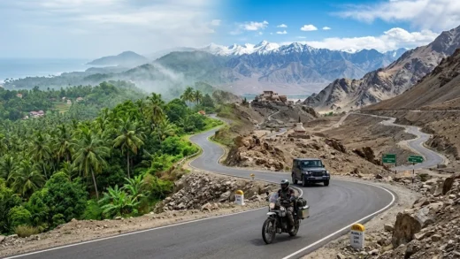
🚙 Enjoy a scenic drive through the remote Changthang region, passing breathtaking high-altitude landscapes and traditional villages.
🦅 Spot Himalayan wildlife such as marmots, blue sheep (bharal), Himalayan birds, and other native species.
🏕️ Experience the vast Changthang Plateau, known for its unique ecosystem and the traditional lifestyle of the Changpa nomads.
📖 Learn about Demchok’s rich history as an ancient frontier settlement between Ladakh and Tibet.
🌄 Enjoy the peace, solitude, and unspoiled natural beauty of one of Ladakh’s most remote destinations.
⚠️ Travel Note: Demchok lies in a sensitive border region. Visitors should check the latest permit requirements and local travel regulations before planning a visit, as access may be restricted.
Travel Tips
🪪 Carry Required Permits: Check the latest permit requirements before planning your trip, as Demchok is located in a sensitive border region.
🆔 Keep Identification Handy: Always carry a valid government-issued photo ID and any permits required during your journey.
🚗 Travel in a Reliable Vehicle: A sturdy SUV or 4×4 is recommended due to the challenging mountain roads.
⛰️ Acclimatize Properly: Spend at least 2–3 days in Leh before heading to Demchok to reduce the risk of altitude sickness.
💧 Stay Hydrated: Drink plenty of water and avoid strenuous activities during the first few days at high altitude.
⛽ Refuel in Advance: Fuel stations are limited in this remote region, so fill your tank before leaving Leh or Nyoma.
🍫 Carry Food and Water: Pack sufficient drinking water, snacks, and basic supplies, as facilities are limited.
📶 Expect Limited Connectivity: Mobile networks and internet services may be unavailable or unreliable in many areas.
Best Time to Visit
Best Time to Visit Demjok Village: May–September
Demchok Weather
- Temperature
- Precipitation
- Rain Chance
- Wind
- Humidity
- Pressure


Near By Places
| Nearest Airport | Kushok Bakula Rimpochee Airport |
| Nearest Bus Station / Stop | Nyoma Bus Stop |
| Nearest Hospital / Clinic | CHC Nyoma |
| Nearest Fuel Station | Indian Oil Petrol Pump Nyoma |
Discover the timeless charm of Ladakh by exploring Demjok village, where tradition, landscapes, and culture come together to offer an authentic and enriching travel experience.