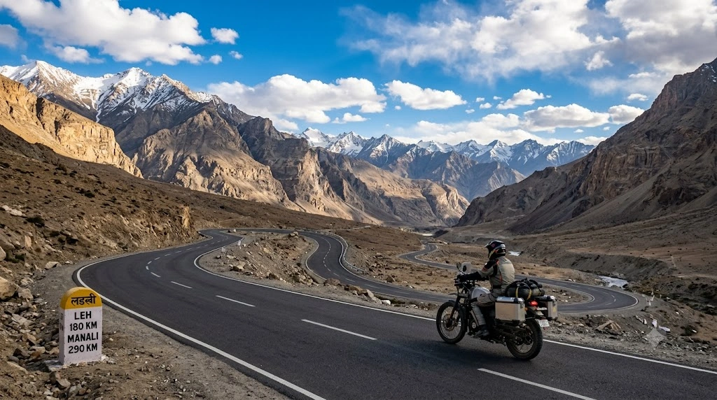
A road trip from Bengaluru to Leh is one of India’s most epic driving adventures, taking you across multiple states, diverse landscapes, and some of the world’s highest motorable roads. Covering around 3,300–3,600 km one way, the journey offers everything from bustling cities and highways to snow-capped mountains and high-altitude deserts.
Whether you’re driving a car or riding a motorcycle, proper planning is essential. This guide covers the best routes, travel time, fuel costs, suggested itinerary, permits, and useful travel tips for a safe and unforgettable journey.
Bengaluru to Leh Distance by Road
- Approximate Distance: 3,300–3,600 km (depending on the route)
- Driving Time: 55–70 hours of driving
- Recommended Duration: 10–14 days (one way)
- Best Time to Visit: June to September
- Highest Altitude: Khardung La (5,359 m) or Umling La (optional)
Since the journey is extremely long, most travelers divide it into several comfortable driving days.

- Temperature
- Rain Chance
- Wind
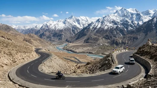
Best Route 1: Bengaluru – Delhi – Manali – Leh (Most Popular)
Approximate Distance: 3,350 km
Route
Bengaluru → Hyderabad → Nagpur → Jhansi → Agra → Delhi → Chandigarh → Mandi → Manali → Jispa → Sarchu → Pang → Leh
Why Choose This Route?
- Most popular among road-trippers
- Scenic mountain roads after Manali
- Famous high-altitude passes
- Plenty of accommodation options
Highlights
- Hyderabad
- Delhi
- Manali
- Atal Tunnel
- Baralacha La
- Nakee La
- Lachulung La
- Tanglang La
- Leh
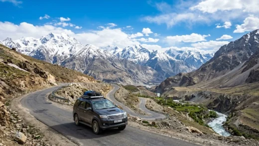
Best Route 2: Bengaluru – Delhi – Srinagar – Leh (Better for Acclimatization)
Approximate Distance: 3,550 km
Route
Bengaluru → Hyderabad → Nagpur → Gwalior → Delhi → Pathankot → Jammu → Srinagar → Sonamarg → Zoji La → Drass → Kargil → Lamayuru → Leh
Advantages
- Gradual increase in altitude
- Easier acclimatization
- Better road conditions in many sections
- Ideal for first-time visitors
Attractions
- Dal Lake
- Srinagar
- Sonamarg
- Zoji La Pass
- Drass War Memorial
- Kargil
- Lamayuru Moonland
Suggested 12-Day Road Trip Itinerary
| Day | Route | Distance |
|---|---|---|
| 1 | Bengaluru – Hyderabad | 570 km |
| 2 | Hyderabad – Nagpur | 500 km |
| 3 | Nagpur – Gwalior/Jhansi | 700 km |
| 4 | Gwalior – Delhi | 360 km |
| 5 | Delhi – Manali | 540 km |
| 6 | Manali | Rest & acclimatization |
| 7 | Manali – Jispa | 140 km |
| 8 | Jispa – Leh | 330 km |
| 9 | Leh sightseeing | Local |
| 10 | Nubra Valley | 120 km |
| 11 | Pangong Lake | 225 km |
| 12 | Return journey begins | — |
Estimated Fuel Cost
Car
- Distance (Round Trip): 6,700 km
- Mileage: 15 km/l
- Fuel Required: ~445 litres
- Estimated Petrol Cost: ₹47,000–₹52,000
Motorcycle
- Mileage: 30–35 km/l
- Fuel Required: ~200 litres
- Estimated Fuel Cost: ₹21,000–₹24,000
Costs vary depending on vehicle efficiency and fuel prices.
Road Conditions
Bengaluru to Delhi
- Excellent National Highways
- Fast expressways
- Plenty of fuel stations
Delhi to Manali
- Mostly good roads
- Mountain driving begins after Mandi
Manali to Leh
- Challenging terrain
- Water crossings
- Gravel sections
- Narrow mountain roads
Srinagar to Leh
- Better gradients
- Occasional landslides
- Good highway stretches
Best Time for Bengaluru to Leh Road Trip
| Month | Conditions |
|---|---|
| May | Roads begin opening |
| June | Excellent |
| July | Green valleys but occasional rain |
| August | Good with possible landslides |
| September | Best weather and fewer crowds |
| October | Cold, snowfall possible |
Essential Permits
You’ll need:
- Valid government-issued ID
- Vehicle documents
- Inner Line Permit (for Nubra Valley, Pangong Lake, Tso Moriri, Hanle, and other protected areas)
- Pollution certificate
- Driving licence
- Vehicle insurance
What to Pack
Documents
- Driving licence
- RC book
- Insurance
- Aadhaar/Passport
- Permit copies
Clothing
- Thermal wear
- Down jacket
- Gloves
- Woollen socks
- Windproof jacket
- Sunglasses
Emergency Essentials
- First-aid kit
- Torch
- Power bank
- Portable tyre inflator
- Tow rope
- Puncture repair kit
- Extra fuel can (where legally permitted)
Health & Safety Tips
- Spend a day acclimatizing in Leh.
- Stay hydrated throughout the trip.
- Avoid alcohol during the first 48 hours at high altitude.
- Eat light meals.
- Drive slowly on mountain roads.
- Start early each morning to avoid afternoon water crossings.
- Keep cash, as ATMs become scarce after Manali and Kargil.
- Download offline maps before entering remote areas.
Must-Visit Places After Reaching Leh
- Leh Palace
- Shanti Stupa
- Magnetic Hill
- Sangam Point
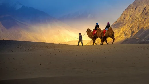
- Nubra Valley
- Pangong Lake
- Tso Moriri
- Khardung La
- Diskit Monastery
- Hemis Monastery
Frequently Asked Questions (FAQs)
How far is Leh from Bengaluru by road?
The road distance is approximately 3,300–3,600 km, depending on the route you choose.
How many days are needed for the trip?
A comfortable one-way journey takes 10–14 days, while a round trip with sightseeing typically requires 18–24 days.
Which route is better?
The Manali–Leh Highway is more adventurous and scenic, while the Srinagar–Leh Highway offers better acclimatization and is recommended for first-time visitors.
Can I drive a sedan from Bengaluru to Leh?
Yes, but SUVs or vehicles with higher ground clearance are better suited for rough mountain roads and water crossings on the Manali–Leh route.
Is the road open throughout the year?
No. The Manali–Leh Highway is generally open from June to September/early October, while the Srinagar–Leh Highway may open slightly earlier and remain accessible a little longer, depending on weather conditions.